
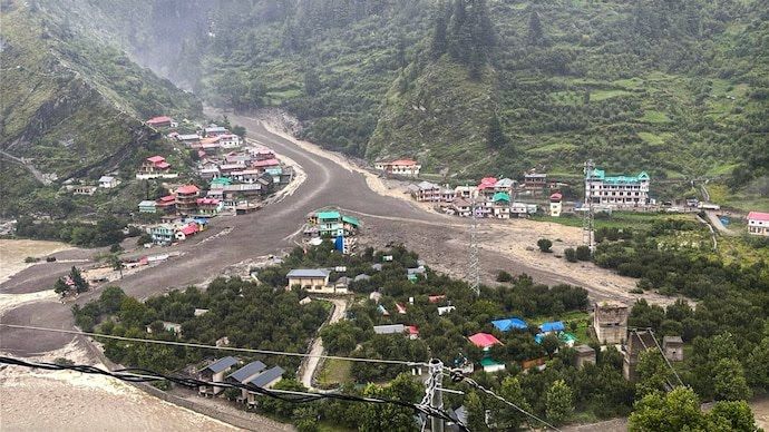
Uttarkashi, Uttarakhand — New satellite imagery has revealed the full extent of the destruction caused by the recent flash floods in Uttarkashi district. Analysis by Suhora Technologies, using Synthetic Aperture Radar (SAR) and high-resolution optical imagery, shows approximately 148 buildings damaged and nearly 16 hectares of land impacted.
The SAR data, captured at 11:01 PM on August 5, offered near real-time insights, enabling accurate mapping of the disaster zones. The findings highlight severe losses to homes, schools, and public infrastructure, underscoring the scale of the humanitarian and logistical challenge.
Rescue operations have intensified, with 65 stranded residents airlifted on Thursday. Efforts are also underway to transport heavy equipment to the isolated Himalayan village of Dharali to aid relief and restoration work.
Critical infrastructure has been hit hard. One bridge has been destroyed, and around 0.95 kilometers of roadway have been damaged, cutting off key routes and complicating the delivery of aid.
“This incident is a stark reminder of the growing vulnerability of Himalayan regions to climate-driven disasters,” said Krishanu Acharya, CEO of Suhora Technologies. “It underscores the urgent need for proactive policies, improved disaster preparedness, and stronger community resilience.”
The combination of satellite analysis and ground-level rescue efforts paints a grim picture and a clear call for sustained investment in safeguarding fragile mountain communities.